Down below, you can take a virtual tour of the Carson Trail using a collection of photos taken along it in years past. This emigrant trail is unique in that it was opened from west to east. However, the emigrants traveled over it from east to west, beginning in 1848, so that is the direction this photo tour travels.
The Carson Trail crosses a very diverse landscape. It starts a short distance north of the Humboldt Bar, a unique geologic feature located at the northeast end of the Humboldt Sink. At this point, the trail turns southeast from the existing California-Truckee Trail and then passes over extremely dry, barren and sandy country as it heads across the 40 Mile Desert to the Carson River.
Upon reaching the river at Ragtown, the trail turns west and generally follows it southwest for about 80 miles through the Carson Valley. Upon reaching the Sierra, the trail and the river both enter the rugged, rocky, scenic canyon of the Carson River. After crossing back and forth across the river several times in about 7 miles, the trail arrives at Hope Valley. In this valley, the emigrants found abundant forage, water and wood so that they could recruit their livestock for the final push over the nearly impossible mountain passes immediately ahead of them.
After passing over the high-elevation mountains at Carson Pass and West Pass, the emigrants had fairly easy traveling down the extensive, heavily- timbered system of mountain ridges nearly all the way to their final destination, old Hangtown, now modern Placerville.
CARSON TRAIL PHOTO TOUR
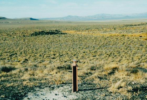
 CR-1 FORKS OF THE TRAIL
This original section of the Carson Trail forks left from the existing California Trail near the marker and heads south across very sandy soil. Photo by Bob Black.
¤ ¤ ¤ ¤ ¤ ¤ ¤ ¤ ¤ ¤ ¤ ¤
 MARKER CR-2 AT THE HUMBOLDT BAR
After going about two miles and passing around the west end of modern Humboldt Lake, the trail climbs to the top of the bar and Marker CR-2. This bar was likely formed by the wave action on Lake Lahontan during prehistoric times. Photo by Bob Black.
¤ ¤ ¤ ¤ ¤ ¤ ¤ ¤ ¤ ¤ ¤ ¤
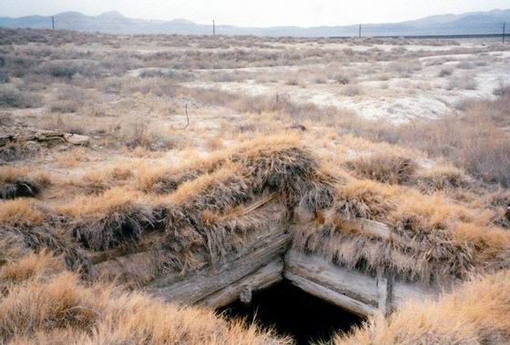
 DOUBLE WELLS
After leaving the bar, the trail continues southwest along the edge of the Humboldt Sink for about four miles to Marker CR-3. The trail passes the marker, crosses over modern Hwy 95, and continues a short distance south to the Double Wells. These wells were likely hand-dug by emigrants to provide the last taste of water, though heavily impregnated with alkali, they would have before reaching the spring at Soda Lake. Photo by Bob Black.
¤ ¤ ¤ ¤ ¤ ¤ ¤ ¤ ¤ ¤ ¤ ¤
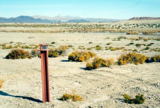
 CR-4 SALT CREEK CROSSING
The trail continues south about 4 miles to the Salt Creek slough. Even though the slough was quite shallow, the emigrants hauled large rocks and placed them in order to make the crossing easier. A few of the rocks can be seen today in the channel a few yards north of the marker. Photo by Bob Black.
¤ ¤ ¤ ¤ ¤ ¤ ¤ ¤ ¤ ¤ ¤ ¤
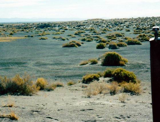
 SAND HUMMOCKS
After crossing Salt Creek, the trail enters a salt flat covered with sand hummocks and mounds. This flat extended about five miles to Marker CR-7, and reminded at least one emigrant of “a level prairie covered with snow.” Photo by Bob Black.
¤ ¤ ¤ ¤ ¤ ¤ ¤ ¤ ¤ ¤ ¤ ¤
 UPSAL HOGBACK
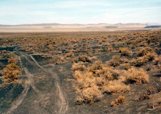
Once past the salt flat, the trail, now the driving road, enters a section of the desert literally paved with small rocks. These rocks are covered with “desert varnish,” which provides the unusual black color. They are very obvious in the vicinity of Upsal Hogback, an unusual desert mountain at Marker CR-8. Photo by Bob Black.
¤ ¤ ¤ ¤ ¤ ¤ ¤ ¤ ¤ ¤ ¤ ¤
 CR-10
CR-10
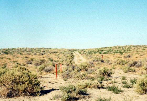
After passing the small ridge in the otherwise flat landscape, the trail, still the driving road, continues across the flat, sandy terrain. Photo by Bob Black.
¤ ¤ ¤ ¤ ¤ ¤ ¤ ¤ ¤ ¤ ¤ ¤
 CR-11
CR-11
From Marker CR-10, the trail continues southwest about a mile on the old road/trail to an OCTA sign which provides the history of the trail in this area. Photo by Bob Black.
¤ ¤ ¤ ¤ ¤ ¤ ¤ ¤ ¤ ¤ ¤ ¤
 CR-11 SODA LAKE
Off to the left of Marker CR-11 is small extinct volcano that holds Soda Lake in its caldera. Near the southwest corner of the lake, a small spring provided welcome relief for the emigrants dying of thirst on the trail. The water in the lake was alkaline and was not fit to drink. At this point, they were still about two miles from the Carson River. Photo by Bob Black.
¤ ¤ ¤ ¤ ¤ ¤ ¤ ¤ ¤ ¤ ¤ ¤
 CR-13 JUNCTION
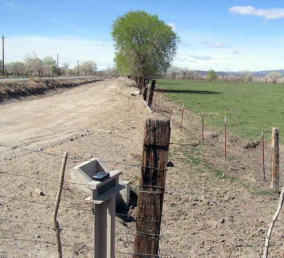
After leaving Ragtown, the trail generally follows the Carson River for about four miles to Marker CR-13. From this point, the wagon trail gradually pulls away from the river in order to bypass the nearly impassable section known as “The Narrows.” This section was passable by pack trains, however, so they continued to follow the river. Photo by Bob Black
¤ ¤ ¤ ¤ ¤ ¤ ¤ ¤ ¤ ¤ ¤ ¤
 CR-14
CR-14
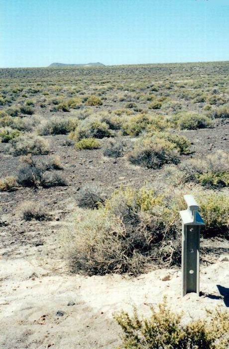
As the trail pulls out of the river valley, it enters a section of “stony bluffs and ridges” near Marker CR-14. Photo by Bob Black.
¤ ¤ ¤ ¤ ¤ ¤ ¤ ¤ ¤ ¤ ¤ ¤
 ROUGH BAD ROAD NEAR CR-15
This marker, barely visible in the photo, is located on a section of original, rocky trail, now a dirt road, located on the south side of an active rock pit. Photo by Bob Black.
¤ ¤ ¤ ¤ ¤ ¤ ¤ ¤ ¤ ¤ ¤ ¤
 ALKALI BED
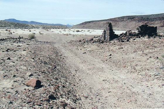
As the trail heads back toward the Carson River, it crosses an old alkali bed that was described by emigrant Hamden Cagwin as “curious dry sinks, level as water, solid as marble.” This section of original trail was later used by stage coaches and was the site of the later Hawes Station. Photo by Bob Black.
¤ ¤ ¤ ¤ ¤ ¤ ¤ ¤ ¤ ¤ ¤ ¤
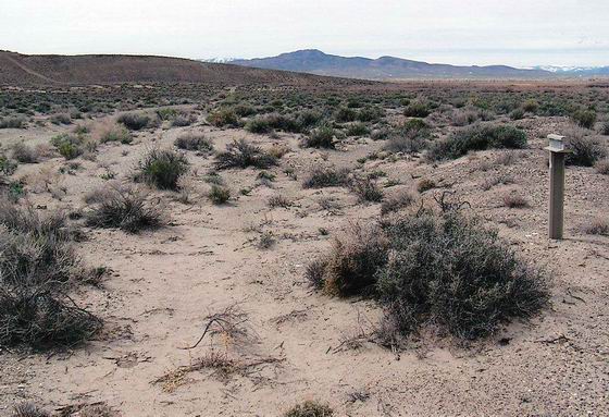
 MARKER CR-17 AT THE RIVER & DESERT ROUTES
At this marker, the trail forks. The left hand fork heads back to the Carson River. The right hand fork is a dry shortcut trail, about 26 miles long, that cuts across the wide bend in the river. The two forks rejoin near the later town of Dayton at Marker CR-26. Photo by Bob Black.
¤ ¤ ¤ ¤ ¤ ¤ ¤ ¤ ¤ ¤ ¤ ¤
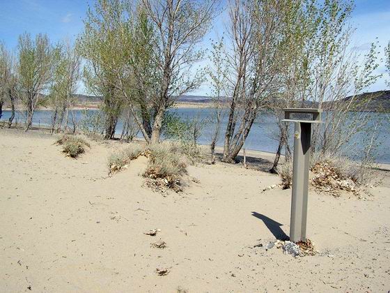
 MARKER CR-18, BEAUTIFUL CAMPING
This was probably what the emigrants thought when they followed the river route. They likely camped in the numerous cottonwood groves along the edge of the reservoir many years before the Lahontan Dam was constructed and the Recreation Area was created. Photo by Bob Black.
¤ ¤ ¤ ¤ ¤ ¤ ¤ ¤ ¤ ¤ ¤ ¤
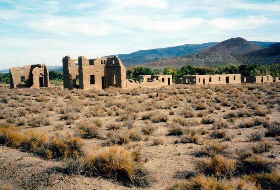
 MARKER CR-19, SONORA TRAIL JUNCTION
As the emigrants continued along the river, they soon came to the junction with the Sonora Trail which was opened in 1852. This area was later the site of Fort Churchill, (the ruins shown in the photo), the Overland Emigrant Trail, and the route of the Pony Express. Photo by Bob Black.
¤ ¤ ¤ ¤ ¤ ¤ ¤ ¤ ¤ ¤ ¤ ¤
SUSAN’S BLUFF AT MARKER CR-20
After following the river for about eight miles west from Marker CR-19, the emigrants had to cross over to the other side of the river. This was necessary in order to get around a basalt bluff that came down to the edge of the river. This obstacle became known as Susan’s Bluff, and was apparently named after Susan O’Brien, who died and was buried near the bluff.
Photo by Bill Bishell.
¤ ¤ ¤ ¤ ¤ ¤ ¤ ¤ ¤ ¤ ¤ ¤
 DESERT ROUTE
This photo shows the flat, dry, sand and rock desert shortcut trail, now a dirt road, about five miles southwest from the trail junction. Photo by Bob Black.
¤ ¤ ¤ ¤ ¤ ¤ ¤ ¤ ¤ ¤ ¤ ¤
 DESERT ROUTE AT MARKER CR-22
This is another photo showing an original section of the dry, sandy, nearly flat trail about eight miles southwest of the trail junction. Photo by Bob Black.
¤ ¤ ¤ ¤ ¤ ¤ ¤ ¤ ¤ ¤ ¤ ¤
 DESERT ROUTE AT MARKER CR-23
This dry, sandy, slowly climbing section of trail, now a dirt road, is about fifteen miles southwest from the trail fork. Photo by Bob Black.
¤ ¤ ¤ ¤ ¤ ¤ ¤ ¤ ¤ ¤ ¤ ¤
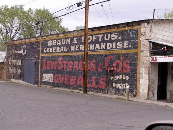
 DAYTON, NEVADA
The combined trail passed through the area that later became the town of Dayton. This photo shows some of the old buildings that are still standing and in use. Photo by Bob Black.
¤ ¤ ¤ ¤ ¤ ¤ ¤ ¤ ¤ ¤ ¤ ¤
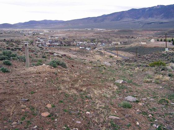
 ROCKY ASCENT
The trail left the river valley and climbed about a mile up the rocky slope, passing several mining sites and the later Dayton cemetery, to Marker CR-27. Photo by Bob Black.
¤ ¤ ¤ ¤ ¤ ¤ ¤ ¤ ¤ ¤ ¤ ¤
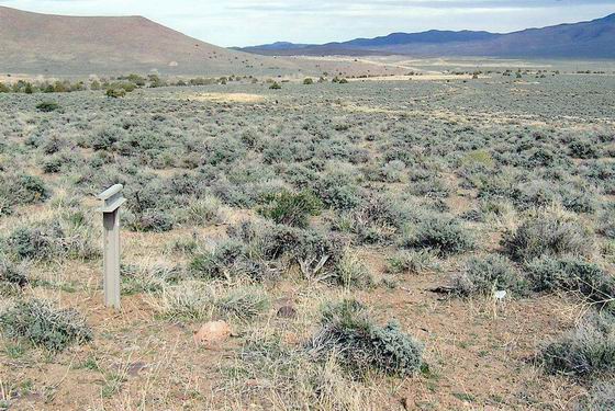
 STONY TRAVEL
Looking along the ‘very stony” trail route coming west from Dayton to Marker CR-28. Photo by Bob Black.
¤ ¤ ¤ ¤ ¤ ¤ ¤ ¤ ¤ ¤ ¤ ¤
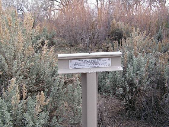
 CR-29 AT THE JOHNSON CUTOFF
This marker has been relocated a short distance and now sits in a parking lot and along a hiking/biking trail which goes along the Carson River. This was the site of the junction with the Johnson Cutoff, which forked off the Carson Trail in 1852. Photo by Bob Black.
¤ ¤ ¤ ¤ ¤ ¤ ¤ ¤ ¤ ¤ ¤ ¤
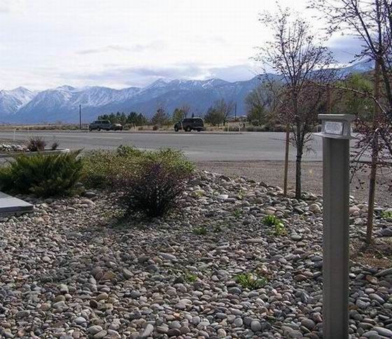
 MARKER CR-31 IN THE CARSON VALLEY
The photo is looking southwest along the trail route across the Carson Valley from the marker located on the side of modern Hwy 395. The steep, snow-covered, heavily timbered mountains along the west side of the valley were a welcome sight for the early emigrants. Photo by Bob Black.
¤ ¤ ¤ ¤ ¤ ¤ ¤ ¤ ¤ ¤ ¤ ¤
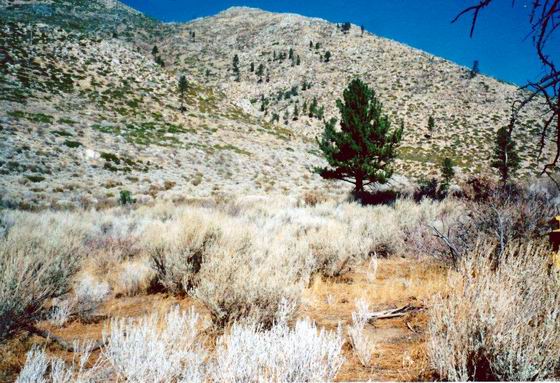
 NEAR CARSON CANYON
This view shows the steep, rocky Sierras along the west side of the Carson Valley just before the trail begins the descent from the gently sloping sagebrush-covered bench to the river valley below. Photo by Bob Black.
¤ ¤ ¤ ¤ ¤ ¤ ¤ ¤ ¤ ¤ ¤ ¤
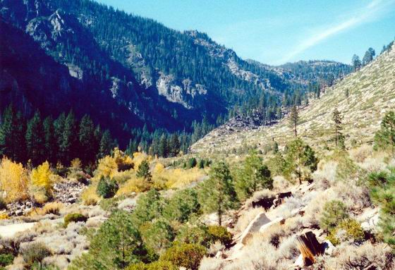
 CARSON (MAD) CANYON
Looking west into the lower end of the canyon near the location of Marker CR-38 at the first crossing of the boulder-choked West Carson River. An emigrant of 1852, Caroline Richardson, referred to this canyon as the “Mad Canyon.” Photo by Bob Black.
¤ ¤ ¤ ¤ ¤ ¤ ¤ ¤ ¤ ¤ ¤ ¤
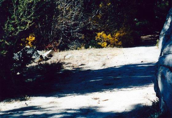
 CROOKED TRAIL
This section of the trail through the canyon was virtually impassible since the point of a small ridge came down to the edge of the river. In order to bypass this area, the trail crawled up the north side of the canyon slope, crossed over a small ridge near the cave where Snowshoe Thompson supposedly camped in the winter, and dropped back down to the trail along the river.
There are several white granite boulders along the trail in this area which show classic “wheel scrapes.” These scrapes are areas on the rock where it has been worn very smooth by the emigrant’s steel-covered wagon wheels. Photo by Bob Black.
¤ ¤ ¤ ¤ ¤ ¤ ¤ ¤ ¤ ¤ ¤ ¤
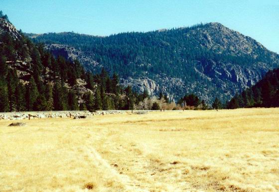
 HOPE VALLEY
Looking east toward the upper end of the canyon. At this point the emigrants could breathe a sigh of relief because they had reached Hope Valley. Here they had abundant wood, water and usually plenty of forage and they could now recruit their livestock for the final climb over the Sierra. Photo by Bob Black.
¤ ¤ ¤ ¤ ¤ ¤ ¤ ¤ ¤ ¤ ¤ ¤
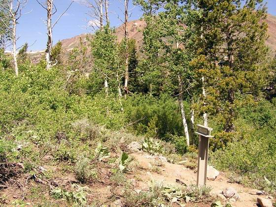
 CR-42
CR-42
Here the trail is coming up the brushy draw below the marker and into the small valley that holds Red Lake. Photo by Bob Black.
¤ ¤ ¤ ¤ ¤ ¤ ¤ ¤ ¤ ¤ ¤ ¤
 CR-42 RED LAKE
The dam had not yet been built so the lake was likely much smaller when the emigrants passed it on the trail to the Devil’s Ladder. This climb up from the lake was described as “the steepest hill for a wagon road I ever saw” according to Aretas J. Blackman in 1849. Photo by Bob Black.
¤ ¤ ¤ ¤ ¤ ¤ ¤ ¤ ¤ ¤ ¤ ¤
 CR-43 CARSON PASS
Once the emigrants reached the top of the Devil’s Ladder, they were nearly to the top of Carson Pass. Many of them wrote their names with axle grease on the granite boulders along the side of the trail. The names have recently been “touched up” with white paint to make them more legible. Photo by Bob Black.
¤ ¤ ¤ ¤ ¤ ¤ ¤ ¤ ¤ ¤ ¤ ¤
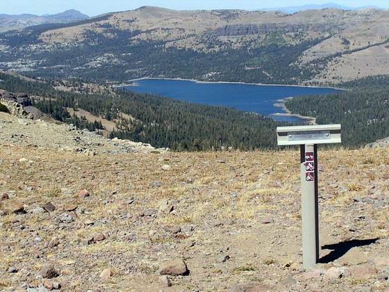
 WEST PASS
This view is north toward Caples Lake. When the emigrants passed through the little valley, the lake was much smaller since the modern dam had not been constructed. Upon reaching the south side of the lake, the emigrants had the long, hard pull up to this pass to look forward to.
At this pass, the emigrants had finally reached the final crest of the Sierra. On Aug 9, 1850, an emigrant, Leander Loomis, found the “American flag, with its stars and stripes floating to the breeze, in its usual bold and majestic manner.” Photo by Bob Black
¤ ¤ ¤ ¤ ¤ ¤ ¤ ¤ ¤ ¤ ¤ ¤
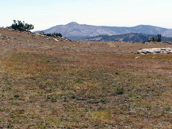
 HEADING DOWN THE RIDGE
From Marker CR-47, the trail begins the descent down the ridge, staying near the mountain crest and along the modern OHV trail located along the edge of the Mokelumne Wilderness Area. Photo by Bob Black.
¤ ¤ ¤ ¤ ¤ ¤ ¤ ¤ ¤ ¤ ¤ ¤
TRAIL BETWEEN MARKERS CR-47 AND CR-48
Looking down a steep pitch in the trail. Several folks who were in the work party that did some maintenance work on the markers can be seen slowly trudging up the steep slope. Photo by Bob Black.
¤ ¤ ¤ ¤ ¤ ¤ ¤ ¤ ¤ ¤ ¤ ¤
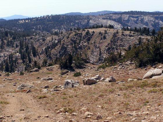
 FROM CR-47 LOOKING TOWARD MARKER CR-48
This is a view down the top of the ridge to Marker CR-48. This marker is located on the top of the small, bare knob in the upper right center of the photo. Photo by Bob Black.
¤ ¤ ¤ ¤ ¤ ¤ ¤ ¤ ¤ ¤ ¤ ¤

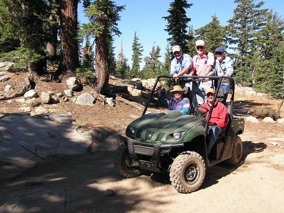
 MODERN “WAGON” USED FOR TRAIL WORK
These two photos show the OHV used by the work party to transport the tools used to maintain the markers. Occasionally, several folks jumped aboard the rig to catch their breath while hiking up the high-elevation trail. Photos by Bob Black.
¤ ¤ ¤ ¤ ¤ ¤ ¤ ¤ ¤ ¤ ¤ ¤
 MARKER CR-49 AT MARTELL FLAT
This small meadow at the marker along the crest of the ridge is about as far as a 4 x 4 vehicle can be driven. The remaining distance to West Pass is accessible only by OHV’s or by hiking.
Photo by Bob Black.
¤ ¤ ¤ ¤ ¤ ¤ ¤ ¤ ¤ ¤ ¤ ¤
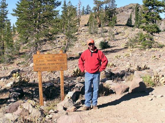
 PLASSE TRADING POST
The marker is located near this sign which describes one of the early trading posts located along the trail in 1852 on the west slope of the Sierra. Photo by Bob Black.
¤ ¤ ¤ ¤ ¤ ¤ ¤ ¤ ¤ ¤ ¤ ¤
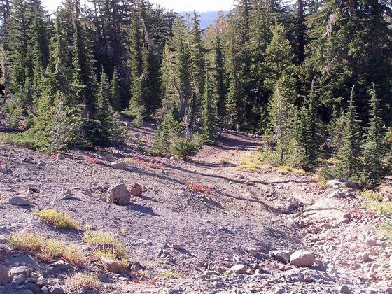
 TRAIL HEADING WEST FROM MAKER CR-50
Here the eroded, rocky section of trail is shown as it drops down into the timber on the way down the ridge toward Marker CR-51. Photo by Bob Black.
¤ ¤ ¤ ¤ ¤ ¤ ¤ ¤ ¤ ¤ ¤ ¤
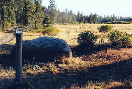
 CR-51 AT MUD LAKE
The small lake located near the marker was often used by the emigrants as it was the first water source they reached after passing over the mountain summit. Photo by Bob Black.
¤ ¤ ¤ ¤ ¤ ¤ ¤ ¤ ¤ ¤ ¤ ¤
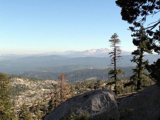
 NEAR MARKER CR-53
This is one of the gorgeous vistas that can be seen along the crest of the Sierras. This view is north toward the Crystal Range and the headwaters of the American River. Photo by Bob Black.
¤ ¤ ¤ ¤ ¤ ¤ ¤ ¤ ¤ ¤ ¤ ¤
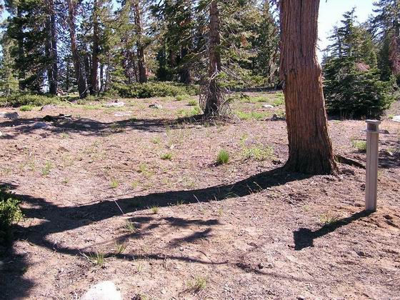
 TRAIL AT MARKER CR-53
A nice section of original trail is visible here as it heads east toward Tragedy Springs.
Photo by Bob Black.
¤ ¤ ¤ ¤ ¤ ¤ ¤ ¤ ¤ ¤ ¤ ¤
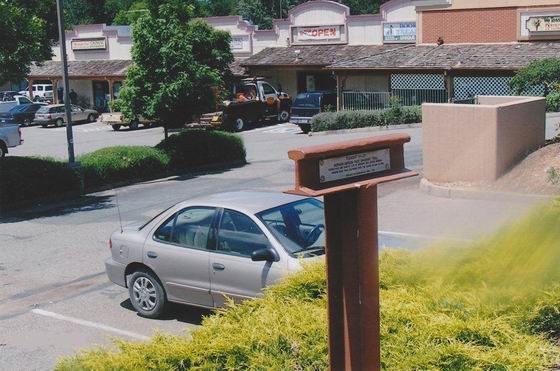
 PLEASANT VALLEY
This is a view of the marker in the Pleasant Valley area as it appears today. In the emigrant era, it was not built up like it is today, but there were numerous gold miners working in the area.
Photo by Bob Black.
¤ ¤ ¤ ¤ ¤ ¤ ¤ ¤ ¤ ¤ ¤ ¤
 MARKER CR-64
This marker is located at Avinsino Corner in Pleasant Valley. It was from this location in 1848 that the Mormon “pioneers” opened up a wagon route eastward over the Sierras and into the Carson Valley. This route soon developed into the Carson Trail. Photo by Bob Black.
¤ ¤ ¤ ¤ ¤ ¤ ¤ ¤ ¤ ¤ ¤ ¤
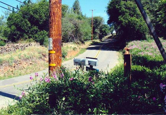
 MARKER CR-68
This marker is located a few miles east of Placerville. In 1848, it would have been along the wagon road that ran from Placerville to the Pleasant Valley area and the numerous mining camps located there. Photo by Bob Black.
We hope you have enjoyed this photo tour of some of the Carson Trail. If you are interested in driving this trail be sure to get a copy of our Driving Guide:
CARSON TRAIL DRIVING GUIDE
Markers CR-1 through CR-69
 CR-1 FORKS OF THE TRAIL
 MARKER CR-2 AT THE HUMBOLDT BAR
 DOUBLE WELLS
 CR-4 SALT CREEK CROSSING
 SAND HUMMOCKS
 UPSAL HOGBACK
 CR-10
CR-10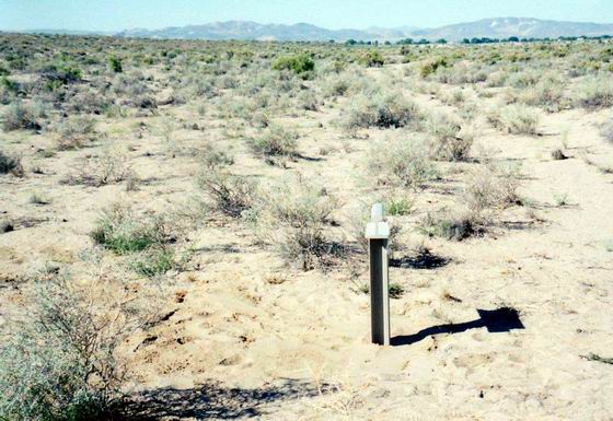 CR-11
CR-11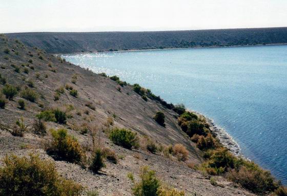 CR-11 SODA LAKE
 CR-13 JUNCTION
 CR-14
CR-14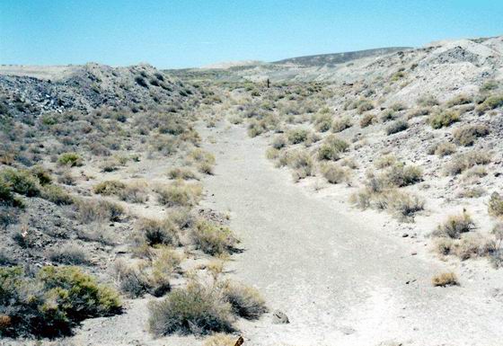 ROUGH BAD ROAD NEAR CR-15
 ALKALI BED
 MARKER CR-17 AT THE RIVER & DESERT ROUTES
 MARKER CR-18, BEAUTIFUL CAMPING
 MARKER CR-19, SONORA TRAIL JUNCTION
 DESERT ROUTE
 DESERT ROUTE AT MARKER CR-22
 DESERT ROUTE AT MARKER CR-23
 DAYTON, NEVADA
 ROCKY ASCENT
 STONY TRAVEL
 CR-29 AT THE JOHNSON CUTOFF
 MARKER CR-31 IN THE CARSON VALLEY
 NEAR CARSON CANYON
 CARSON (MAD) CANYON
 CROOKED TRAIL
 HOPE VALLEY
 CR-42
CR-42 CR-42 RED LAKE
 CR-43 CARSON PASS
 WEST PASS
 HEADING DOWN THE RIDGE
 FROM CR-47 LOOKING TOWARD MARKER CR-48
 MODERN “WAGON” USED FOR TRAIL WORK
 MARKER CR-49 AT MARTELL FLAT
 PLASSE TRADING POST
 TRAIL HEADING WEST FROM MAKER CR-50
 CR-51 AT MUD LAKE
 NEAR MARKER CR-53
 TRAIL AT MARKER CR-53
 PLEASANT VALLEY
 MARKER CR-64
 MARKER CR-68